
REVIEW · MEXICO CITY
Trekking Through The Volcanoes
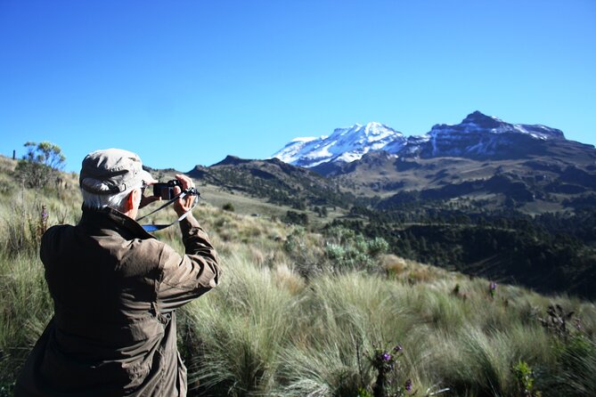
Volcano views begin well outside Mexico City. This full-day trek takes you into Iztaccíhuatl and Popocatépetl National Park, where you walk through pine forest, open mountain country, and volcanic terrain between two of Mexico’s best-known peaks. I like the small group limit of 13 and the fact that trekking poles, a backpack, food, and private transport are included. The traditional tacos and quesadillas after the hike are another strong point.
The main caution is altitude. You begin around 3,500 meters, or roughly 11,800 feet, and climb toward 4,000 meters, close to 13,000 feet. The path is not highly technical, but thin air, steep sections, loose ash, dust, and a hike of roughly 9 to 13 kilometers can make this a serious day outdoors.
Key points before you book
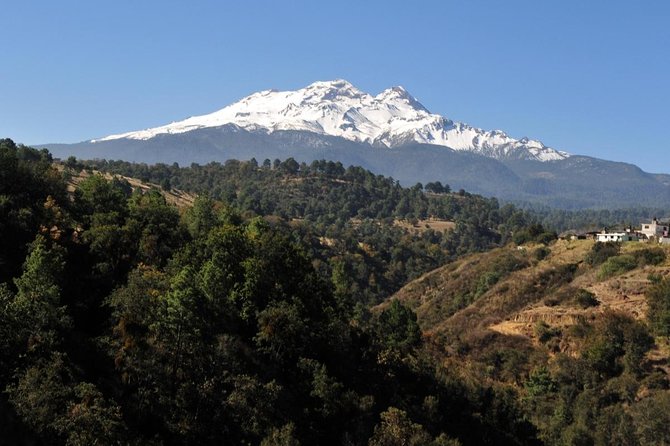
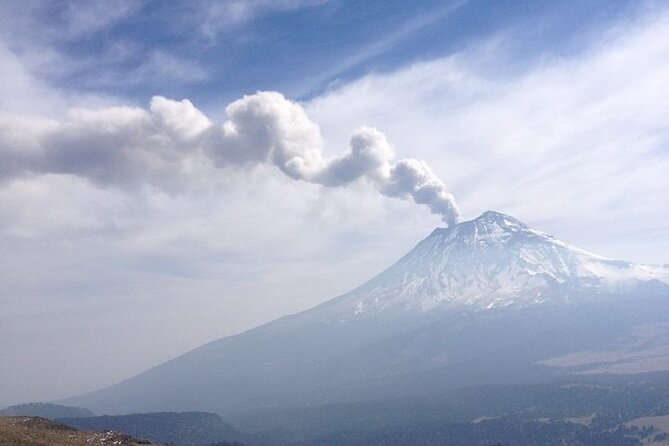
- Walk between two famous volcanoes: The route gives you views of Iztaccíhuatl and the active Popocatépetl, including its fumarole when conditions allow.
- Expect a real mountain hike: The route includes forest, dirt roads, rocky sections, slopes, and high-altitude walking rather than a gentle city excursion.
- Lunch is part of the experience: You receive trail food and drinks, then stop at a traditional market or roadside taquería for tacos and quesadillas.
- Guides make the difference: Guides such as Carlos, Bernardo, Alan, Sergio, Alberto, and Salva have been praised for pacing, safety checks, and local information, though the amount of commentary can vary.
- Pack for changing conditions: Mornings can be cold and windy, while sunshine and exertion may have you peeling off layers later.
- Allow a full day: Pickup is at 7:00 a.m., the drive takes about two hours each way, and the full outing may run beyond the advertised nine hours.
What makes this volcano trek worth your time
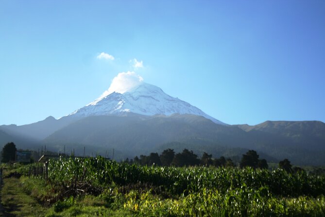
I like this trip because it gets you far beyond Mexico City without asking you to arrange a van, national park transport, route finding, food, or hiking equipment yourself. You spend the day in high mountain country, then return to the city after a proper Mexican meal. That is a useful mix of scenery and local flavor.
The setting is the real prize. Iztaccíhuatl is often called the Sleeping Woman because of the shape of its snowy ridges. Popocatépetl is an active volcano, and its fumarole may be visible from the route when weather and volcanic conditions cooperate. You do not climb either summit on this outing. Instead, you walk their lower slopes and viewpoints, which makes the day far more manageable than a summit attempt.
The tour is rated 4.8 from 96 ratings, with 95 percent of people recommending it. Those numbers fit the strongest parts of the experience: striking views, careful guides, a well-organized transfer, and an excellent meal at the end. The weaker points are also consistent. Some guides provide a great deal of information, while others focus mainly on leading the group and keeping everyone together.
More Volcano Hikes and Treks in Mexico:
- Iztaccihuatl Volcano Hike with an Alpinist
★ 4.0 · 244 reviews - Mexico City: Guided Volcano Trek with Lunch
★ 4.7 · 242 reviews - From Mexico City: Hike Iztaccihuatl Volcano with an Alpinist
★ 4.3 · 155 reviews
The two-hour ride from Condesa
Pickup is at 7:00 a.m. on Avenida Vicente Suárez in Condesa. You return to the same meeting point at the end, which is convenient if you are staying in or near central Mexico City.
The drive to the national park takes about two hours each way. That makes the outing a long day, but it also explains why this is a useful option for visitors without a rental car. The road can be winding, so I would bring motion sickness medicine if you normally need it. One stop for restrooms may be made during the drive, but there are no proper facilities at the trailhead or along the route.
The van has been described as comfortable, though taller people may prefer a front-row seat. Bring small cash for bathrooms if needed, along with toilet paper. Those are minor details, but they matter on a mountain day.
The company provides private transportation, and the group size is capped at 13. That is small enough for the guide to check on your breathing and pace. Some departures have included two guides, which is particularly helpful when the group has mixed fitness levels.
Paso de Cortés and the first forest section
The hike begins at Paso de Cortés, a high saddle between the volcanoes. From here, the route heads through forest with Iztaccíhuatl ahead. The opening section gives you a gradual introduction to the altitude, though the air may already feel noticeably thin if you have just come from Mexico City.
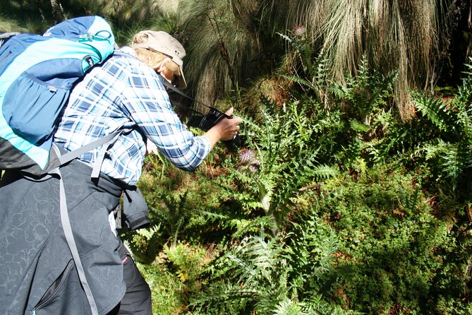
The forests provide shade, mountain air, and a welcome change from the city. You may also see varied plant life and, possibly, some local fauna. Do not expect a formal wildlife excursion. The attraction is the combination of trees, open slopes, distant peaks, and the sense that you have left the city far behind.
The path is often a dirt road or broad trail rather than a narrow technical route. That makes footing easier than on a steep climbing path, but the surface can be dusty, rocky, or slippery. One useful tip is to cover your mouth or nose in dusty sections. Several people have found that the fine volcanic ash rises easily as the group walks.
At this stage, go slowly. The guide may set a steady pace, but you should speak up if you are short of breath. High altitude can turn an ordinary uphill slope into hard work, even for someone who exercises regularly at sea level.
Cerro Altzomoni and views toward Popocatépetl
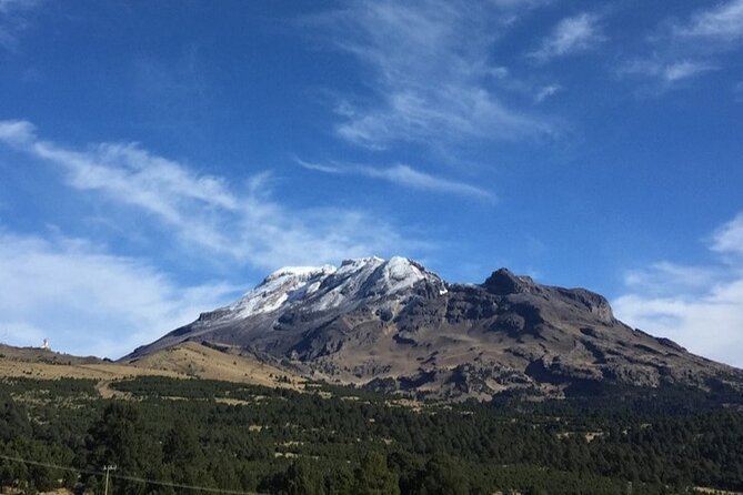
The route climbs toward Cerro Altzomoni, one of the key viewpoints of the day. Here, the view toward Popocatépetl becomes the central attraction. On a clear day, you can see the volcano’s broad form and may spot its fumarole.
This is one of the best reasons to choose the longer route if you have the fitness for it. The additional walking brings more open views and a stronger sense of being between the volcanoes. The scenery changes as you move from forest toward alpine grassland and more exposed ground.
Weather controls how much you see. Rain, cloud, haze, and wind can hide the peaks, especially during the rainy season. Even then, the high-altitude setting, trees, slopes, and changing vegetation still make a worthwhile walk, but you should not book this solely for a guaranteed volcano photograph.
Several guides have been praised for stopping often, explaining what is ahead, and checking how everyone is handling the air. Carlos has received particular praise for combining route knowledge with a warm, attentive manner. Bernardo has also been noted for explaining the geology, plants, and animals while keeping an eye on the group. That level of care is valuable here because the route is shared by people with different hiking backgrounds.
A few more volcano trips around Mexico worth a look
- The Fire TOUR – Pyramids, Volcanoes, Agaves & Tequila
★ 5.0 · 329 reviews - Hiking Excursion to the Iztaccíhuatl Volcano from Puebla
★ 5.0 · 74 reviews - Hike at Nevado de Toluca Volcano
★ 5.0 · 69 reviews - Hiking Tour on the Iztaccíhuatl Volcano from Puebla
★ 5.0 · 44 reviews
The Amalacaxco ravine and the waterfall section
After the higher viewpoint, the route descends toward the Amalacaxco ravine. This part adds variety to the day. Instead of looking only at distant peaks, you move through a more sheltered area with plants, rock, and changing ground.
A waterfall or glacial stream is one of the memorable features reported along the route. In colder conditions, you might see icicles around the water and plants. That detail gives the hike a much more alpine feel than the simple word trekking suggests.
The descent is not automatically easy. Loose ground can be tiring on the knees, and wet or icy patches require care. Hiking poles are provided, and I would use them, especially on steep or slippery sections. They also help when the trail becomes dusty or uneven.
The route eventually returns toward Paso de Cortés. Depending on the selected loop and conditions, the total hike may be around 9 kilometers or closer to 13 kilometers. One account described roughly 13 kilometers with about 400 meters of climbing, while another described a six-mile outing. In practical terms, plan for five hours of walking, breaks included, and ask the guide at the start which route is planned.
One drawback deserves a clear mention: part of the final stretch may use a road with vehicles. The first 8 or 9 kilometers can feel remote and peaceful, while the last several kilometers may be less pleasant because of cars. This is not a deal breaker for me, but it does mean the trek is not wilderness walking from start to finish.
Food, water, and the traditional Mexican meal
The included food is more generous than a token snack. Your backpack includes a liter of water, a 600-milliliter energy drink, a chocolate energy bar, peanuts, fruit snacks, and a sandwich or similar packed item depending on the departure. The exact combination may vary, but you should have enough to keep moving during the hike.
The final meal is a separate pleasure. On the return journey, the group stops at a traditional market or roadside Mexican restaurant for tacos and quesadillas. Squash-flower tacos have been singled out as a memorable choice, and the meal offers far more local character than a boxed lunch eaten beside the van.
The timing also works well. After five hours of walking at altitude, you will want real food. The meal is usually around the early afternoon, then you continue back toward Mexico City.
I would still carry a small personal snack if you have dietary needs or a large appetite. The supplied food is substantial, but a mountain hike can make even a full pack seem modest.
How hard is the hike?
The simplest answer is moderate, with altitude making it harder than the trail itself suggests.
The route is not a summit climb and does not require technical mountaineering. The paths are generally walkable, and some sections are broad dirt roads. Still, there are steep uphill stretches, loose rocks, dusty ash, and a long distance. At roughly 3,500 to 4,000 meters, each breath does less work than it would at city level.
You should be comfortable walking uphill for extended periods and completing a 9 to 13-kilometer day. You do not need elite fitness, but this is not a casual stroll. People in good shape have described it as manageable, while others have found the altitude strenuous even when the trail looked easy.
The guides generally allow breaks and adjust for the group. Alberto has been praised for stopping often to make sure everyone was handling the altitude. Carlos has also helped people who needed extra support near the end. That is reassuring, but you remain responsible for being honest about how you feel.
If you have spent several days in Mexico City before the hike, you may have had some time to adjust to altitude. That does not guarantee an easy day, but it may help. If you have just arrived from low elevation, consider giving yourself more time before booking this outing.
What to wear and carry
The supplied backpack and poles cover useful basics, but you still need the right clothing and shoes.
Start with layers. The morning can be around 8 degrees Celsius, windy, and cold. Later, sun and uphill effort may make you comfortable in a T-shirt. A fleece, trousers, and a warm outer jacket are sensible. A hat and sunglasses help in exposed areas.
Wear sturdy hiking shoes or boots with good grip. The path can be rocky, slippery, wet, or covered in loose ash. Bring sunscreen, even if the morning begins under cloud, and consider a face covering or neck gaiter for dusty stretches.
Your own water bottle can supplement the supplied drinks. Keep your day pack light, because you may already be carrying the provided food and water. Cash, toilet paper, and motion sickness medication are practical additions for the drive and rest stops.
Guides, group size, and the quality of the day
The guide can shape this experience more than any other single factor. Carlos, Bernardo, Alan, Sergio, Alberto, and Salva have all been associated with strong days on this route. The best guiding includes clear route instructions, regular altitude checks, information about the volcanoes, and a willingness to match the group’s pace.
Do not assume every departure will offer the same amount of commentary. Some guides explain geology, flora, fauna, and the history of the volcanoes. Others have been quiet, acting mainly as route leaders and safety monitors. If you want more information, ask questions directly. The guides who respond well can add a great deal to the walk.
The small group promise is important here. A maximum of 13 allows more personal attention than a large bus excursion. If two guides are present, one can stay toward the rear while the other leads. That helps keep the group together without forcing the strongest walkers too far ahead.
The experience is offered in English. Service animals are allowed, and most people who can participate in a demanding high-altitude hike should be able to join, but the physical demands remain the key issue.
Is $133.34 good value?
At $133.34 per person, the price is fair for a full day that includes private transportation, guides, a national park outing, trekking poles, a backpack, trail food, drinks, and a cooked Mexican lunch.
The two-hour drive each way is a major part of the cost. You are paying not only for the hike but also for the logistics of reaching a remote mountain area without arranging a car. Add the provided equipment and two meals, and the price compares well with what you might spend organizing the same day yourself.
The value is strongest if you want a guided walk and do not already have mountain gear or transport. It is weaker if you are seeking a silent, self-directed hike or a summit climb. This outing stays on the lower parts of the volcanoes and focuses on views, forests, ravines, and access rather than technical ascent.
Free cancellation is available up to 24 hours before the 7:00 a.m. start for a full refund. Poor weather or failure to reach the minimum group size can also lead to a new date or full refund.
Who should book this Mexico City day trip?
I would choose this for someone who wants a serious day in nature without planning a multi-day mountain expedition. It suits hikers with above-average fitness, people comfortable with long walks, and visitors who have already spent enough time in the city and want something completely different.
It is also a good choice for solo visitors. The small group gives you company without the feel of a large coach tour, and the shared meal creates an easy social finish.
I would hesitate if you dislike winding drives, struggle with altitude, need guaranteed clear volcano views, or want a short and relaxed outing. Families may be able to participate, but the distance, cold start, dust, and elevation mean that children must be comfortable with a long mountain walk.
FAQ
Where does the tour start?
The meeting point is Av. Vicente Suárez 38 in Colonia Condesa, Mexico City. The tour starts at 7:00 a.m. and ends back at the same meeting point.
How long does the experience last?
The advertised duration is about nine hours. The full day may last a little longer, especially because the drive takes about two hours each way.
How far is the hike?
The route may be about 9 or 13 kilometers, depending on the selected loop and conditions. Several accounts describe around 13 kilometers, with about 400 meters of elevation gain.
How high does the hike go?
The route begins at roughly 3,500 meters and may climb toward 4,000 meters, or close to 13,000 feet. The tour does not climb to the summits.
Is Popocatépetl active?
Yes. Popocatépetl is an active volcano, and the route may offer views of its fumarole. Visibility depends on weather and conditions.
What food and drinks are included?
The supplied pack includes water, an energy drink, a chocolate energy bar, peanuts, fruit snacks, and a sandwich or similar food. A traditional meal of tacos and quesadillas is included after the hike.
Are hiking poles and backpacks provided?
Yes. Trekking poles and a backpack are provided. The guides also carry safety equipment.
What happens if I need to cancel?
You can receive a full refund if you cancel at least 24 hours before the start time. Cancellations or changes made within 24 hours are not refunded. Poor weather or an insufficient group size may result in another date or a full refund.
Should you book it?
Book this if you want dramatic volcano views, a proper mountain walk, and a local meal in one well-organized day. The guides, gear, transport, and small group make the $133.34 price reasonable, especially if you are visiting Mexico City without a car.
Go prepared for thin air, dust, cold mornings, steep sections, and a long ride. If you accept those conditions and choose sturdy footwear, this is one of the better ways to trade city streets for Mexico’s high volcanic country without committing to a summit expedition.
Just added around Mexico
- Volcano Hiking Tour from Puebla★ 5.0 · 7 reviews
- Hiking in Iztaccihuatl Volcano★ 5.0 · 11 reviews
- Hiking Excursion to the Iztaccíhuatl Volcano from Puebla★ 5.0 · 74 reviews
- Volcano Tour to Iztaccihuatl★ 5.0 · 2 reviews
- Paricutin Volcano Tour (Morelia)★ 5.0 · 5 reviews
- Private Hike next to volcano at 14800 ft. from Mexico city★ 4.5 · 12 reviews
- Iztaccihuatl Volcano Tour from Mexico City★ 5.0 · 23 reviews
- Hike at Nevado de Toluca Volcano★ 5.0 · 69 reviews
Volcano Hikes & Treks, compared.
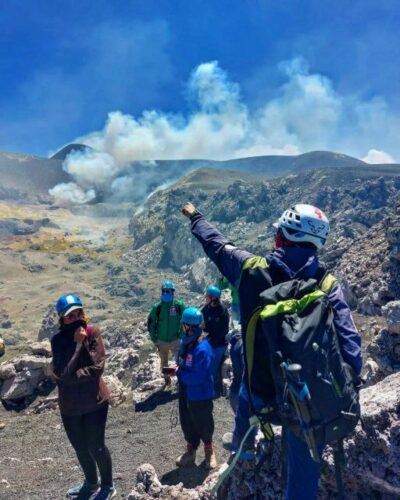
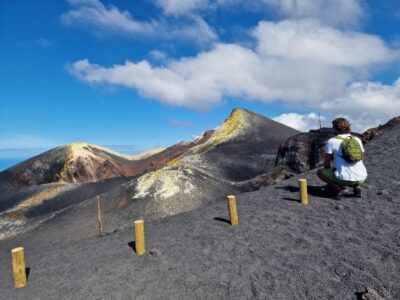

summit craters trekking with volcano guide 3350mt
Our review of it →
Mount Etna Trekking Tour Beyond the Tourist Trails
Our review of it →
Stromboli: Sunset Trekking at Sciara del Fuoco
Our review of it →Browse the lists this tour appears in